We empower decision makers with geospatial intelligent visual information by aggregating their eco-system data on a single, shareable photo realistic 3D platform.
We empower organizational management decision making by providing 3D geospatial intelligence technology solutions.
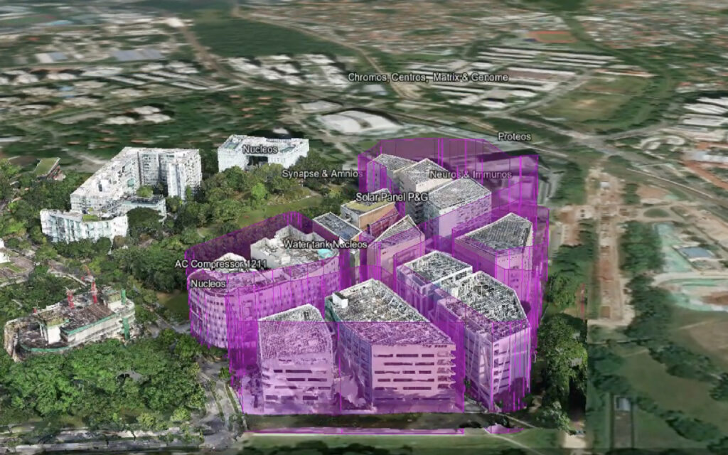
Our technology capture real-time representation of land, assets and objects down to measurable precision of centimetres.
Capture changes over time providing visual audit history.
Smart City Development
A platform to visualise in 3D business applications from different departments, organisations, agencies without any development.
Common platform for technical and business applications to IoT sensors from security CCTVs , Heating, Ventilation, Air Con (HVAC) to wayfinding systems.
Shareable tool to access, view and analyse from any device, anywhere, anytime.
Why Choose Us
Assess
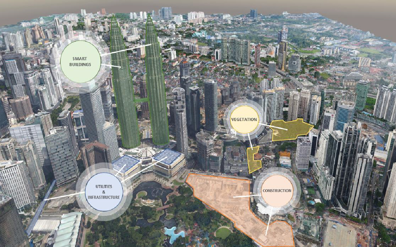
View the visibility of amenities, transportation routes to aid urban planning over large expanse of land.
Build
Simplify complex data to reduce time spent on decision making.
Plan
Compare architectural models with physical models.
Maintain
Optimize productivity and ensure the safety of maintenance workers.
Operate
Monitor real time information through CCTV and IoT.
“GIS enables business enterprises to improve
decision making and boost operational
efficiency, leading to their increased adoption.”
Awards & Recognition
Graffiquo has been invited to numerous professional Visual Intelligence exhibitions across Southeast Asia. These exhibitions are an opportunity to showcase our advanced visual intelligence and data software.
AWS City on a Cloud
Graffiquo was announced as the Winner of the Gamechangers Award in 2020. The Gamechangers Award officially recognizes ground-breaking innovations in major cities across the globe.
Cities of the Future
Graffiquo was presented with the New Innovation Champion Award in 2021. This invite-only competition highlighted innovative startups within the ASEAN region.
United Nations
Graffiquo has also led the United Nations U4SSC initiatives program within the South East Asia and ASEAN cities.
Latest News
The current query has no posts. Please make sure you have published items matching your query.